REGION AFRIQUE DU NORD
|
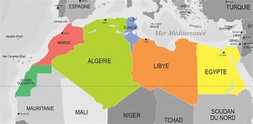
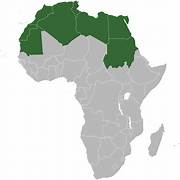
Geography The map of North Africa is a precious tool to understand the geography and diversity of this region. Delimited by the Mediterranean in the north, the Atlantic Ocean at the Oxest, the Red Sea in the East, and extending to the Sahara in the South, North Africa covers a considerable area. This card offers an AFERVIE of the countries and geographic characteristics of this region. The map of North Africa reveals that this region is made up of several distinct countries. Among the most important are Morocco, Algeria, Tunisia, Libya and Egypt. Each country has its own history, culture and identity. However, the Arabic language is widely used in the region and Islam is the dominant religion. |
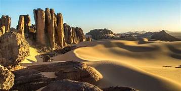
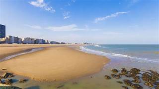
By examining the map, we can also see that North Africa has great geographic diversity. To the north, there is the Mediterranean Litoral, with its golden beaches and blue waters. This region benefits from the Mediterranean climate, characterized by DEC hot summers and dry and rainy winters. The Atlas mountains extend through several countries in North Africa, offering superb landscapes and a great natural richness. The map also shows that North Africa is crossed by DEC mountain chains, including the Atlas mountains, which extend over hundreds of kilometers. These mountains are EsSesions for the region, because they provide fresh water and house a unique biodiversity. In addition, the Moroccan High Atlas is a popular site for hiking and exploration of nature.
culinary
- CARTHAGE - TUNIS
- MARRAKHECH
- CASABLANCA
- GHARDAIA
- CHARL EL-CHEIKH, Égypte
- HAMMAMET, Tunisie
- TAGHAZOUT, au Maroc
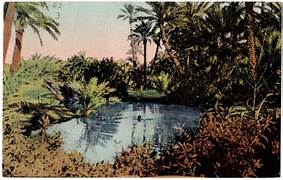
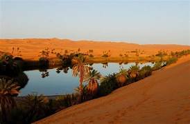
- The oasis
- the oasis (literally "inhabited place") is a space cultivated intensively in a desert environment. These domesticated ecosystems, based on a multitude of water mobilization methods, share a certain number of very original characteristics: polyculture-elevation systems, a staging of vegetation whose dominant stratum is often made up of date palm trees , very intensive culture systems, and a collective space organization (Toutain, 1987; Batteti, 2005). This common trait however covers a great diversity of forms in the oases of North Africa, which can be distinguished according to their economy, their agro-climatic situation or their structure